TopoNavigator GPS Info 1.3
Free Version
Publisher Description
Toponavigator GPSInfo is a useful tool that utilizes all sensors of your device and especially the GPS to give you basic info about your position and your trip, with the ability to store NMEA log, send your coordinates to your contacts and provide a complete figure of your trip.
Designed to be an extension of the cartographic application TopoNavigator Android, Toponavigator GPSInfo operates independently.
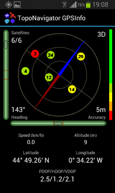
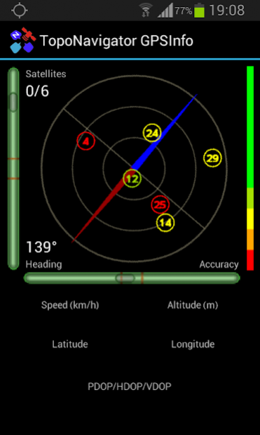
The main page shows the magnetic compass, the fleet of visible satellites and intensity of the signals and two gradiometers showing pitch & roll sensor values.
The Trip Computer page displays.
trip duration data (Total time, Moving time)
Distance
Speed data (Current value, Average Speed, Min. Speed, Max. Speed)
Elevation data (Current value, Min. Elevation, Max. elevation, Total ascending, Total descending)
Movement Bearing in both degrees and cardinal values.
GPS and battery status.
Values can be reset during current session.
"New Section" provides Duration & Distance for a new lap.
Features:
Completeness: Plenty of information on GPS fix status (number of visible / in-use satellites, accuracy, azimuth, location coordinates, altitude, PDOP / HDOP / VDOP)
Plenty of information on trip figures (Total time, Moving time, Distance, current Speed, Average Speed, Min. Speed, Max. Speed, current Elevation, Min. Elevation, Max. elevation, Total ascending, Total descending.
Versatility: Representation of the geometry of satellites and GPS position quality with color symbols. Duration & Distance values can be calculated for unlimited number of lap.
Minimal consumption: Adjustable switching frequency of GPS fix, automatic screen turn-off
Responsiveness: Utilization and management of A-GPS data
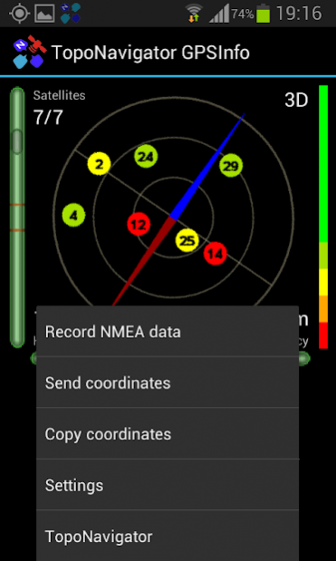
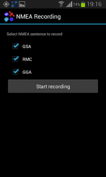
Compatibility: GGRS87 planar coordinates. WGS84 geographic coordinates in all common formats (Decimal Degrees, DegMin.Min, DegMinSec), speed in km/h, mph & m/sec, export NMEA sentences to a file for post-processing.
Other features: Coordinates Send by e-mail or SMS with direct access to your contacts. Copy coordinates to Clipboard. Sensor calibrating. Full screen mode. Display options. Monitors NMEA files volume. GPS and battery status displayed in Trip Computer. English, Greek & French labels
About TopoNavigator GPS Info
TopoNavigator GPS Info is a free app for Android published in the Recreation list of apps, part of Home & Hobby.
The company that develops TopoNavigator GPS Info is AnaDigit. The latest version released by its developer is 1.3. This app was rated by 1 users of our site and has an average rating of 5.0.
To install TopoNavigator GPS Info on your Android device, just click the green Continue To App button above to start the installation process. The app is listed on our website since 2013-11-09 and was downloaded 15 times. We have already checked if the download link is safe, however for your own protection we recommend that you scan the downloaded app with your antivirus. Your antivirus may detect the TopoNavigator GPS Info as malware as malware if the download link to anadigit.toponavigator.gpsinfo is broken.
How to install TopoNavigator GPS Info on your Android device:
- Click on the Continue To App button on our website. This will redirect you to Google Play.
- Once the TopoNavigator GPS Info is shown in the Google Play listing of your Android device, you can start its download and installation. Tap on the Install button located below the search bar and to the right of the app icon.
- A pop-up window with the permissions required by TopoNavigator GPS Info will be shown. Click on Accept to continue the process.
- TopoNavigator GPS Info will be downloaded onto your device, displaying a progress. Once the download completes, the installation will start and you'll get a notification after the installation is finished.
